Choosing between South Boulder and Central Boulder can feel like comparing two great versions of Boulder living. Maybe you want easy access to Pearl Street and CU. Or maybe your priority is a quiet street near a trailhead and a smoother Denver commute. In this guide, you’ll get a clear, data-informed way to compare both areas so you can focus on what matters most to you. Let’s dive in.
How this guide defines each area
To keep things apples-to-apples, use the City of Boulder’s official subcommunity boundaries for “South Boulder” and “Central Boulder.” You can see those on the City’s subcommunity map and use them as your reference point for any numbers you collect. If you need to go deeper, the City outlines how to convert those polygons into census tracts so you can pull consistent housing data.
- Reference map: the City’s subcommunity planning overview explains the boundary approach and includes a map image of the subcommunities. You can start there for consistent neighborhood lines. City of Boulder subcommunity map
The quick view: South vs. Central
Here is a side-by-side snapshot to ground your search. It blends housing feel, walkability, trail access, commuting, and a recent market snapshot.
| Factor | South Boulder | Central Boulder |
|---|---|---|
| Housing stock | More single-family homes, many midcentury ranches in Table Mesa and Martin Acres; larger yards are common. | Denser mix with many condos and townhomes near downtown, plus pockets of historic single-family homes. |
| Walkability feel | Mixed. Shopping nodes like Table Mesa score higher; foothill-edge blocks are more car dependent. | Very walkable to Walker’s Paradise in core areas near Pearl Street and CU. |
| Trail access | Immediate foothills access near Table Mesa and Chautauqua; quick reach to South Boulder Peak trails. | Close to Mount Sanitas, Boulder Creek Greenway, and downtown green spaces. |
| Denver commute access | Strong access via US-36 and the Table Mesa Park-n-Ride for the Flatiron Flyer BRT. | Easy to Downtown Boulder Station for BRT; slightly longer to US-36 if you are deep in downtown. |
| Market snapshot | Median sale price about $1,045,000; about $534 per sq ft; median 51 days on market. | Median sale price about $1,035,000; about $696 per sq ft; median 103 days on market. |
Source note: The market figures above reflect Redfin neighborhood sold-price medians for January 2026. Vendor medians vary by neighborhood boundary and data method.
Walkability and everyday errands
Boulder’s overall Walk Score sits in the mid-50s, but it varies a lot block by block. Downtown and University Hill tend to score higher, often falling in Very Walkable to Walker’s Paradise categories. That is why Central Boulder often feels easy for car-light living.
South Boulder is more mixed. If you live closer to Table Mesa shopping, you can run many errands on foot or by bike. If you are on the foothills edge, you will likely rely more on a car. You can dig into the categories and methods in the Walk Score methodology and browse the Boulder Walk Score overview as a quick proxy.
Trails and open space access
Boulder’s Open Space and Mountain Parks system covers roughly 45,000 acres with well over 100 miles of trails. That scale is a big reason people choose to live here. South Boulder shines for quick foothills access from Table Mesa and the Chautauqua area, which is a historic, heavily visited trailhead with ongoing infrastructure and visitor management projects. You can see current projects on the City’s page for Chautauqua infrastructure improvements.
If you lean Central, Mount Sanitas and the Boulder Creek Greenway are close for daily hikes and runs. The City tracks active work at Mount Sanitas on its trail project page. For a big-picture view of Boulder’s protected open space, this OSMP overview gives helpful scope and context.
Commuting and regional access
If you commute to Denver, the US-36 corridor matters. The Flatiron Flyer bus rapid transit runs all day and stops at both Table Mesa and Downtown Boulder Station. Many South Boulder addresses are minutes from the Table Mesa Park-n-Ride, which can simplify the daily routine for Denver-bound commuters. You can review the route and stations on RTD’s Flatiron Flyer page.
For drivers, CDOT’s express lanes on US-36 aim to improve travel time reliability between Boulder and Denver. That context helps you compare South’s quick access to US-36 with Central’s proximity to Downtown Boulder Station. Learn more on CDOT’s US-36 Express Lanes page.
Housing feel and types
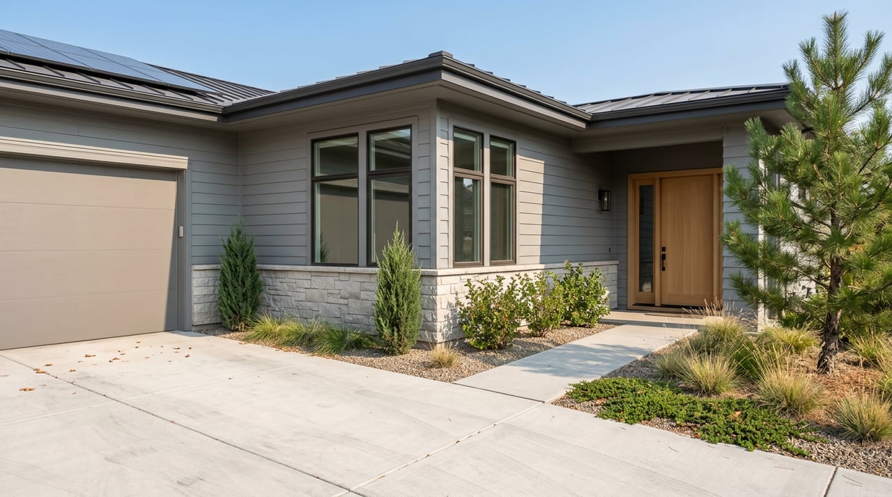
If you want more single-family options with yards, South Boulder is a strong match. You will see many midcentury ranches and family-oriented subdivisions like Table Mesa and Martin Acres. Blocks often read quieter, especially as you move toward the foothills.
If you want more condos and townhomes with easy downtown access, Central Boulder is a strong contender. You can find a mix of newer infill and historic homes on smaller lots, plus a high concentration of multifamily near Pearl Street and CU. That variety can give you more entry points into the market right in the core.
Price snapshots and what they mean
Neighborhood medians vary by data provider because definitions differ and methods vary. As of January 2026, Redfin’s neighborhood sold-price medians show South Boulder around the low-to-mid one million range, with about $534 per square foot and a median of about 51 days on market. Central Boulder sits at a similar median sale price, with a higher price per square foot and a longer median days on market.
Other vendors, including Realtor.com, display different medians for similar time frames. The reason is simple. Each provider draws different neighborhood lines and may report listed medians instead of sold medians. When you compare prices, always note the provider and the date window so you are reading the numbers correctly.
How to run your own compare
Use this quick, reproducible checklist to validate what you see on tours and online:
- Step A: State your boundary choice. Example: “Using City of Boulder subcommunity polygons for South Boulder and Central Boulder.” See the City subcommunity map.
- Step B: Pull core metrics for each area. Walk Score category, median sale price and price per square foot, median days on market, percent single-family vs multifamily, median year built, distance to one or two major trailheads, and commute times to Downtown Boulder and Denver. For Walk Score method details, use the Walk Score methodology. For trail context, reference the City’s Chautauqua improvements or Mount Sanitas project. For transit to Denver, check the Flatiron Flyer.
- Step C: Synthesize the tradeoffs. Summarize what the numbers say in plain language. For example: “Central is more walkable with a higher condo share. South offers more yard space, faster access to US-36, and immediate foothills trails.”
Which area is right for you
If you live for downtown energy and want to walk to restaurants, shops, and campus-adjacent amenities, Central Boulder likely fits well. If you prioritize quiet streets, more yard, trailheads in your backyard, and a smoother Denver commute, South Boulder rises to the top. Many buyers find clarity after one or two focused tours that contrast core blocks in Central with foothills-edge streets in South.
When you are ready to pressure-test your short list, schedule a private consult to align homes, trail access, and commute logistics with your daily routine. You will get local, data-backed guidance on live listings and micro-locations that fit how you actually live. If you want a tailored plan, reach out to Mary Wood for a one-on-one neighborhood consultation.
FAQs
What are the official boundaries for South and Central Boulder?
- The City’s subcommunity map is the best canonical reference for neighborhood lines and is a strong starting point for any data pulls. See the City of Boulder subcommunity map.
Is South Boulder cheaper than Central Boulder right now?
- Recent Redfin neighborhood sold-price medians for January 2026 show similar overall medians in the low-to-mid one million range, with Central posting a higher price per square foot and longer days on market due to its denser, walkable core and diverse housing mix.
Which area is better for commuting to Denver?
- South Boulder offers quick access to US-36 and the Table Mesa Park-n-Ride for the Flatiron Flyer BRT, while Central Boulder is close to Downtown Boulder Station; both connect to the same corridor served by RTD and CDOT’s express lanes. Review RTD’s Flatiron Flyer and CDOT’s US-36 Express Lanes for context.
How walkable are Central Boulder and South Boulder?
- Central Boulder often lands in Very Walkable to Walker’s Paradise zones near Pearl Street and CU, while South Boulder varies by block, with higher scores near shopping nodes and more car-dependent foothill-edge streets; see the Walk Score methodology for how scores are calculated.
Where are the most popular trailheads near each area?
- South Boulder connects quickly to Chautauqua and South Mesa trail networks, with active projects detailed on the City’s Chautauqua improvements page, while Central Boulder sits near Mount Sanitas and the Boulder Creek Greenway; see the Mount Sanitas trail project for updates.